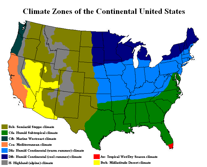
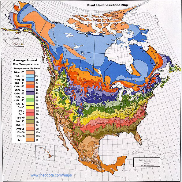
The United States is a huge country with widely differing climates depending on the region, ranging from polar in Alaska to tropical in Hawaii and southern Florida.
Other climate types include Marine Westcoast climate along the northwest coast of Washington and Oregon states; a Mediterranean climate along the California coast; alpine climate in the high mountainous regions such as the Rockies; a desert climate in parts of California, Arizona, Nevada, and Utah; semiarad steppe climate; humid subtropical climate in much of the southern United States; and humid continental climate, with cold wet winters and warmer summers, in much of the northeastern US.
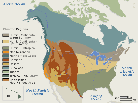
Most of Canada's land area is subartic, with arctic tundra in the far north. The bulk of Canada's population, however, lives in southern Canada near the US border where climate conditions are different. The coastal area of British Columbia has a marine westcoast climate, similar to that of the American northwest; most of southern Canada has a humid continental climate, with warm summers and cold winters; and in southwestern Canada there are mountainous alpine regions and semiarad regions. These semiarad regions can be extremely hot in the summer (I have experienced 42 degrees in the Okanagan region) but quite cold and snowy in winter.
Here they are! Climate maps: United States and Canada.

I hope you found these climate maps United States and Canada to be useful and informative. Be sure to check back for future map collections and geographic profiles. See you next time!